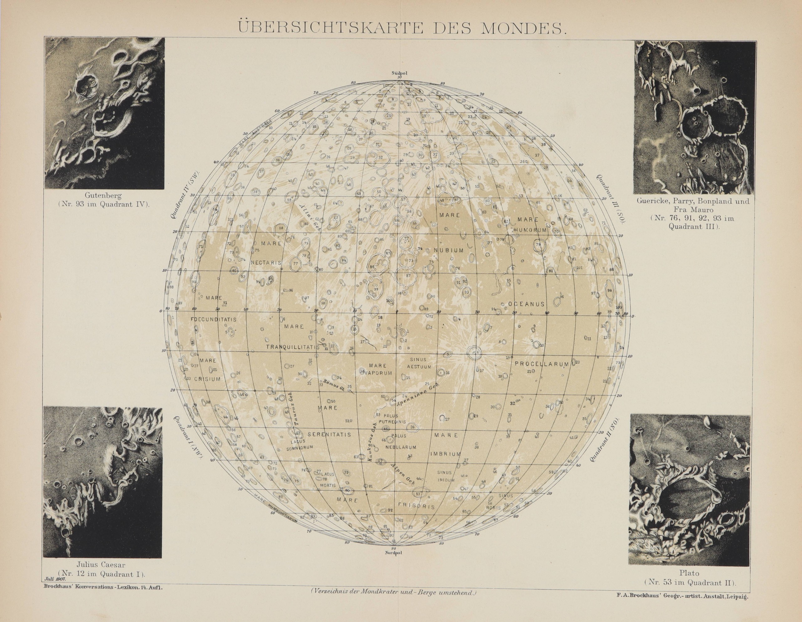
Moon map: craters and mountains
FRIEDRICH ARNOLD BROCKHAUS (editor)
Leipzig, 1907.
Lithograph on cellulose paper.
Good condition.
Lunar cartography, also known as selenography, was a discipline that required rigor and infinite patience. It was about transferring, through a system of coordinate grids, what was perceived in the telescope.
But the light that travels unimpeded from the Moon is disturbed by the lower layers of the atmosphere, making the images returned by the telescope blurry, making it difficult to specify the details of the lunar craters and mountains. A cartographic atlas could be a task that took years and decades. The arrival of photography came to the aid of this task of delicate translation of the image from the telescope to the plane.
One of the first discoveries that came with the telescope was the discovery of lunar craters, elements that today we inescapably associate with lunar geography but that cannot be perceived with the naked eye.
Lunar craters have been produced by the impact of meteorites on the lunar surface, which barely has a protective atmosphere. Most of these craters were formed in an early phase of the Moon, about 4 billion years ago, but they continue to occur today. The size of the craters are very diverse, ranging from millimeter sizes to the 2500km South Pole-Aitken impact basin. Their shape also varies depending on the impact: the largest ones usually have central mountains due to the rebound of the meteorite on the surface. Others show stepped terraces or contain smaller craters inside.